


Product Details
+
Features
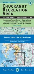
- Made of waterproof, tear-resistant material, with topographic detail printed in full color
- Covers parts of Whatcom County and Skagit County, including Blanchard Forest Block, Pine and Cedar Lakes, Larrabee State Park, Lake Padden Park, Fragrance Lake and Oyster Dome
- Precisely indicates all official trails and trailheads and includes park, campsite and useful contact information
Technical Specs
| Best Use |
Hiking |
|---|---|
| Folded Dimensions |
9.1 x 4 x 0.4 inches |
| Unfolded Dimensions |
27.5 x 25 inches |
| Map Scale |
1:10560 |
| Double Sided |
Yes |
| Publisher |
Square One Maps |
| Copyright Year |
2015 |
| State / Province |
Washington |


![BBK Mass Air Meter Ford Mustang GT 4.6L (1996-1998) [86mm CAC] 19lb / 24lb](https://www.outdoornavig.shop/image/bbk-mass-air-meter-ford-mustang-gt-46l-1996-1998-86mm-cac-19lb-24lb_5OxWTy_285x.webp "BBK Mass Air Meter Ford Mustang GT 4.6L (1996-1998) [86mm CAC] 19lb / 24lb")


 by Expedition Essentials")

: Rituals of Rhllor Chapter Pack")
