


Product Details
+
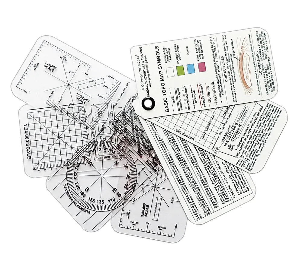
Land Navigation is a critical survival skill for outdoorsmen, SAR team members, and any wilderness professional. ESEE's Compass Cards provide a pocket-sized set of tools and references that greatly simplify and speed up basic navigation tasks like plotting grid reference points, determining distance and magnetic declination, shooting azimuths, and more. ESEE designed its Compass Cards for for use with compass and scaled map or GPS. An included UTM Grid Reference overlay assists in plotting location on Universal Transverse Mercator map projections.
Features:
- Weighs just 1 oz. and measures 2.13” x 4.25” x .13” for easy pocket carry.
- Three double-sided instruction cards provide navigation and map reading fundamentals.
- Four transparent map overlay cards for calculating azimuths, UTM coordinates for GPS and Topo map, distance, area, kilometers to miles, miles to kilometers, and magnetic declination.
- Includes the following metric scales: 1:24,000, 1:25,000, 1:250,000, 1:50,000, 1:100,000
- Includes a tangent table for triangulating distance and location.


![Beckson Soft-Mate Mini Radio Holder - Black [HH-81B]](https://www.outdoornavig.shop/image/beckson-soft-mate-mini-radio-holder-black-hh-81b_fI8BOs_285x.webp "Beckson Soft-Mate Mini Radio Holder - Black [HH-81B]")


