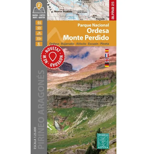
This 2 map set shows the Ordesa National Park in the Pyrenees that includes the peak of Monte Perdido. Detailed on the map are various walking and hiking routes (PR routes) plus the section of the GR11 long distance path that runs through the Ordesa National Park.
Map 1 covers Valle de Anisclo and Valle de Pineta, whilst map 2 covers Valle de Ordesa and Monte Perdido. Also included are the contact details (phone numbers and website) for the various refuges (mountain huts) that are shown on the maps.
Published by Editorial Alpina in 2024, the map key/legend is in Spanish, German, French, and English text throughout. The map is GPS compatible.
Map Scale is 1:25,000.
ISBN is 9784880909952.


![Veratron AcquaLink NavSensor [A2C59501981] Veratron AcquaLink NavSensor [A2C59501981]](https://www.outdoornavig.shop/image/veratron-acqualink-navsensor-a2c59501981_f40FsW_285x.webp)

![RAM Mount Marine Electronics Mount - Gimbal Bracket Under 5lbs. [RAM-B-111U] RAM Mount Marine Electronics Mount - Gimbal Bracket Under 5lbs. [RAM-B-111U]](https://www.outdoornavig.shop/image/ram-mount-marine-electronics-mount-gimbal-bracket-under-5lbs-ram-b-111u_r9K5yl_285x.webp)


![Balmar Alternator 120 AMP 12V 1-2" Single Foot Spindle Mount Dual Vee Pulley Regulator Temp Sensor [621-VUP-MC-120-DV] Balmar Alternator 120 AMP 12V 1-2" Single Foot Spindle Mount Dual Vee Pulley Regulator Temp Sensor [621-VUP-MC-120-DV]](https://www.outdoornavig.shop/image/balmar-alternator-120-amp-12v-1-2quot-single-foot-spindle-mount-dual-vee-pulley-regulator-temp-sensor-621-vup-mc-120-dv_AJWuZT_285x.webp)
