


Product Details
+
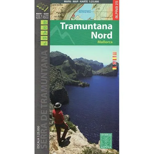
This map covers the northern section of the Sierra de Tramuntana Mountains from Fornalutz up to Pollenca, and it clearly shows the GR221 long distance path. The map comes with booklet that describes various walking and hiking routes, the GR221 route, mountain biking routes, places of interest and accommodation options.
Published by Editorial Alpina in 2016, the map key/legend and the booklet are in Spanish, Catalan, German, and English text throughout. The map is GPS compatible.
Map Scale is 1:25,000
Folded size is 115mm x 210mm
Booklet has 136 pages.
ISBN is 9788480906487.
![Navionics NAUS005R - U.S. North - Navionics [010-C1368-30]](https://www.outdoornavig.shop/image/navionics-naus005r-us-north-navionics-010-c1368-30_qiYgK7_285x.webp "Navionics NAUS005R - U.S. North - Navionics [010-C1368-30]")


